
Discover Cheshire’s most popular walking routes amongst a landscape rich in natural beauty. From ancient woodlands to dramatic sandstone ridges, wild moorland to rolling pastures, and winding canals to charming rural villages – Cheshire is waiting to be explored, one step at a time!
Best Walks in Cheshire
Cheshire may often be dismissed as a walking destination, however in reality the county is packed with rugged and undulating terrain. Step onto the high ground and you’re rewarded big sweeping views – Snowdonia to the west, the Pennines to the east, and everything in between. The real bonus of hill walking in Cheshire is accessibility. You can squeeze in a summit before lunch or stitch a few together for a full‑day adventure. And you are never that far from civilization, which generally means you’re never far from a good cafe or pub!
Below are some of the best and most popular hill walks in Cheshire, each with its own character, quirks and viewpoints – so grab a backpack and let’s head for a wander
- Shining Tor
- Shutlingsloe
- Helsby and Frodsham Hill
- Delamere Forest
- The Sandstone Trail
- The Delamere Way
- White Nancy (Kerridge Hill)
- Alderley Edge
Shining Tor
Walking Route: Shining Tor from Errwood Reservoir
Take on the highest peak in Cheshire and experience one of the most impressive viewpoints in the county on this 6 mile circular route. Shining Tor lies between the towns of Buxton and Macclesfield, and is situated within the Cheshire boundary of the Peak District National Park. It occupies an upland position, with its summit offering extensive views of the Cheshire Plain, Shutlingsloe (aka the Cheshire Matterhorn), the city of Manchester and on a clear day the mountains of Snowdonia.
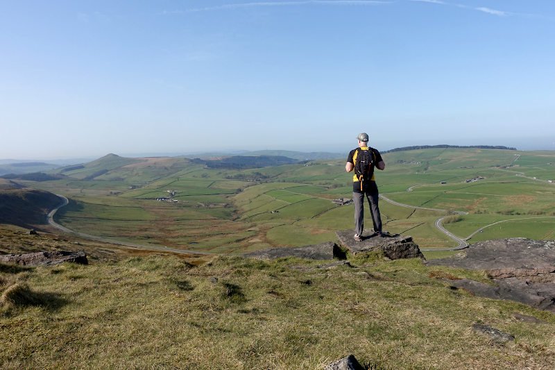
Shining Tor can be approached by different routes, for a short bimble its an almost flat 1.4 mile walk from the Cat and Fiddle, situated along the A537 Buxton New Road. There is limited lay-by parking opposite the entrance to what was once England’s second highest pub, and is now a working Whisky and Gin distillery! For a more challenging and rewarding walk, including the summit of Cats Tor and the ruins of Errwood Hall the above mentioned 6 mile circular route is the way to go!
Shutlingsloe
Walking Route: Shutlingsloe from Macclesfield Forest
Conquer the third‑highest peak in Cheshire on this 4‑mile circular walking route. Shutlingsloe stands proud at 506 m (1,660 ft), its pyramid‑shaped summit rising cleanly from the surrounding landscape and earning it the affectionate nickname the Cheshire Matterhorn – a comparison that’s more about silhouette than scale, but one that sticks the moment you see it!
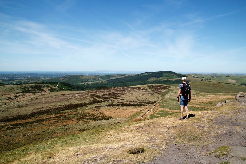
Set beside Macclesfield Forest and above the village of Wildboarclough – reputed home of England’s last wild boar – the hill offers a steady ascent from all sides. The summit rewards the effort with sweeping views across Cheshire and far beyond.
Helsby and Frodsham Hill
Walking Route: Helsby and Frodsham Hill Circular Walk
This 7 mile circular walk incorporates sections of the sandstone trail in addition to the summits of Frodsham and Helsby Hill. Frodsham Hill (175 m) rises gently above the Mersey estuary, its wooded slopes giving way to broad viewpoints where the trees thin and the landscape opens out. From the top, long views sweep across the Cheshire Plain, the estuary, and rolling farmland beyond.
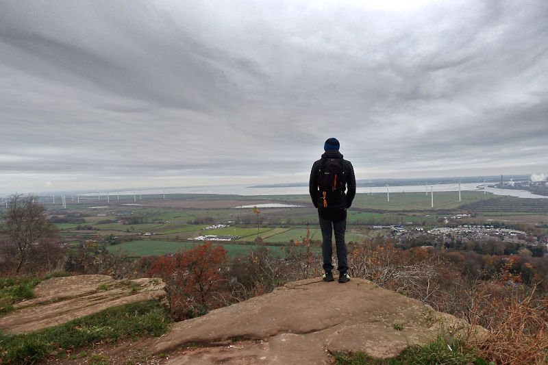
Helsby Hill (141 m) rises steeply above the Mersey estuary, its sandstone cliffs giving the hill an unexpectedly rugged feel. From the summit, wide views open across the Cheshire Plain, Liverpool’s skyline and out towards the Welsh hills, making it a striking and rewarding high point despite its somewhat modest height.
Delamere Forest
Delamere Forest is a vast area of woodland situated in the heart of Cheshire. Its landscape of deciduous and evergreen trees, bogs and lakes is interspersed by a network of undulating walking trails. The high-point at Delamere is called Pale Heights (176m), it sits atop Old Pale Hill and offers expansive panoramic views. Notable landmarks are identified by metal plaques within a stone circle at the summit itself.
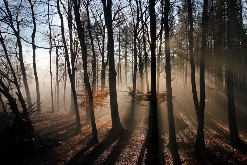
Short way-marked walking routes starting from the visitor and cafe complex will introduce you to the forest. Wander beyond these routes and you will find miles of forest paths sprawled under the forest canopy. Head off the main fire-roads to find solitude, observe the diverse flora and fauna or setup your hammock for an afternoon snooze! The onsite cafe serves tasty breakfast and lunch dishes, using locally sourced ingredients where possible. On the edge of the forest The Carriers Inn is a pub by Hatchmere lake, a small nature reserve which allows overnight fishing.
Getting there: Sat Nav postcode is WA6 6NZ, or Delamere Train station (a short walk from the visitor centre) is on the Mid-Cheshire Line, with trains running from Chester and Manchester.
Parking: Free layby parking along Ashton Road, Whitefield car park is pay and display or you can park at the visitor centre by Old Pale Hill – also pay and display.
The Sandstone Trail
The Sandstone Trail is a long-distance footpath stretching 34 miles (55 km) from the market town of Frodsham in Cheshire to Whitchurch in Shropshire. The trail is undulating with approx 1,000 metres (3,000 ft) of ascent in total, and includes sandstone ridges, woodland, farmland and canal towpaths. Amongst the highlights along the route are Delamere Forest, Beeston Castle and Peckforton Castle.
Typically walkers will complete the walk in 3 days, although if you’re fit its easily doable in 2 with an overnight stop in Beeston or Tattenhall. The starting point for the trail is signified by a distinctive sandstone obelisk situated outside the Bears Paw pub, a 3 minute walk from Frodsham train station. Incidentally there is also a train station in Whitchurch so you can do this walk car free. Full route details on the official sandstone trail website.
The Delamere Way
Walking Route: Discovering the Delamere Way
Discover rural west Cheshire on foot by walking or trail running the 21 mile Delamere Way long distance walking route between Warrington and Frodsham, via Delamere Forest.
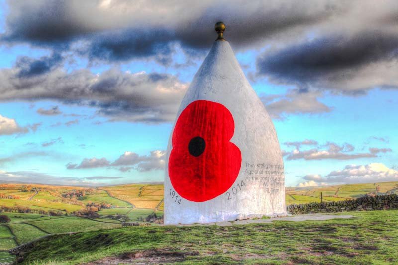
White Nancy (Kerridge Hill)
Situated above the Cheshire town of Bollington is Kerridge Hill (313m / 1027ft) and the feature landmark of White Nancy. The distinctive 5 metre high cone shaped structure is located on the ridge of the hill, which forms part of the Gritstone Trail long-distance footpath. Extensive views from the ridge include the Cheshire Plain, North Wales and Shropshire – making this a popular location for both walkers and photographers.
Alderley Edge
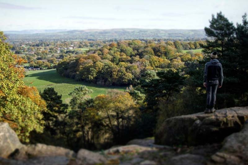
Alderley Edge is a wooded sandstone escarpment situated close to the affluent town of the same name. Its popular for short woodland walks and boasts an impressive viewpoint of the Cheshire Plain and distant Peak District hills.
Explore the wood by following the way-marked paths which start from the National Trust car park (chargeable to non-members). Once your done head to The Wizard Tearoom which is accessible from the car park. Note – the car park is off the B5087 Macclesfield Road by the pub itself, sat-nav postcode SK10 4UB.
Remember – we cannot highlight all potential hazards when out in the great outdoors. Safety is ultimately down to you. Educate yourself in safety, weather reports, navigation and equipment specific to the activity you intend to undertake and conditions/terrain you may encounter! Check out adventuresmart.uk for general outdoor safety considerations – and activity specific guidance for hill walking, paddle boarding, mountain biking and open water swimming.