
This standout walking route leads you to the highest point in Cheshire, where the airy summit of Shining Tor reveals expansive views stretching as far as the eye can see.
Distance: 9.4km (5.8m) / Elev Gain: 300 m
High Point: Shining Tor - 559 m
GPS Download: Shining Tor from Errwood Reservoir
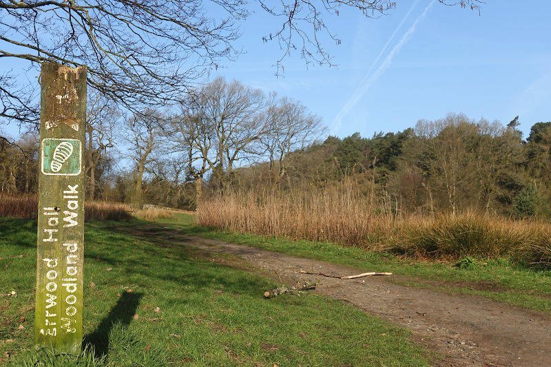
Starting Point: Errwood Hall car park
Walk Overview
This route ticks many boxes – ancient woodland, ruins, a river crossing (easy peasy!), flora and fauna (including birds of prey), a stone shrine, old roman road, mountain summits, a plethora of impressive views, and a decent work out – all packed into less than 10km and right here in Cheshire.
The circular walk kicks off at Errwood Reservoir, tucked away in the Goyt Valley. From here, you’ll climb steadily up to Cats Tor, a fine warm-up summit that sets the tone for the ridge walk ahead. The real prize is Shining Tor, the highest point in Cheshire, where the views stretch far and wide.
Once you’ve conquered the ridge and soaked up the views, the descent loops you back down towards the reservoir, where you can smugly tell anyone loitering in the car park that yes, you’ve just been to the top of Cheshire!
The route is straightforward, well-trodden, and popular with walkers who like their hills accessible but still rewarding. Parking is available at Errwood Hall or The Street, both by Errwood Reservoir. Note – there are no facilities at either.
Walk Highlights
Errwood Hall Ruins
The first significant point of interest on this walk are the tucked‑away ruins of Errwood Hall, a once‑grand Victorian estate built by Manchester merchants in the 1840s, who transformed this quiet corner of the Peaks into a lavish country retreat.
Today, only crumbled walls, mossy stonework and scattered foundations remain, hinting at the Grimshawe family’s opulent past, now blurred into the landscape by heather and rhododendrons!
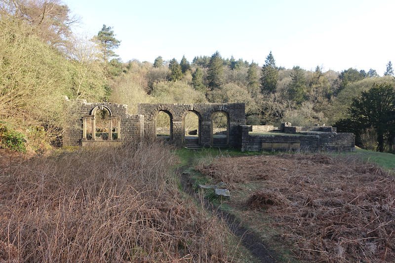
For those into urban exploration this is actually a pretty cool place to spend some time.. Right, enough of the history lesson and back onto the business of the walk…
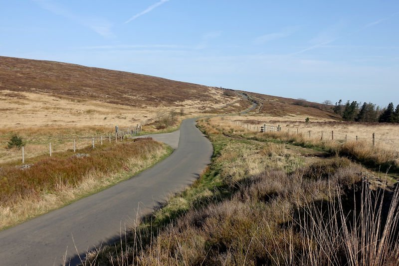
The Street
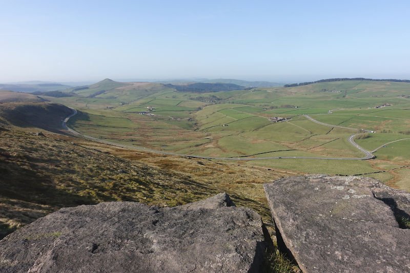
The Street is an old Roman road that cuts across the high moorland above Errwood and Fernilee Reservoirs. The route joins the upper stretch of The Street after an optional detour to St Joseph’s Shrine (further info below). Simply follow the road (or parallel running path) as it climbs steadily toward the top of the ridge. This section gives you easy elevation, big skies, and a clear sense of the valley opening out behind you.
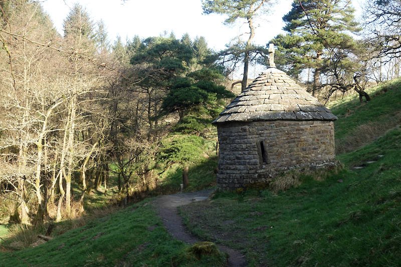
Just before joining The Street, a short side‑path leads to St Joseph’s Shrine – a small circular stone shrine with a conical roof, tucked amongst pines on the hillside. It’s a quiet, atmospheric landmark and a natural pause point on the walk. It’s worth having a little peek inside, and to build some anticipation I’ve refrained from including any photos here!
Cats Tor
The summit of Cats Tor (522m) may feel like a mere wind‑brushed bump, but the ridge it sits on is anything but. Sweeping views carry you along the rolling moorland spine toward Shining Tor, with Shutlingsloe – Cheshire’s own Matterhorn – standing proud on the horizon.
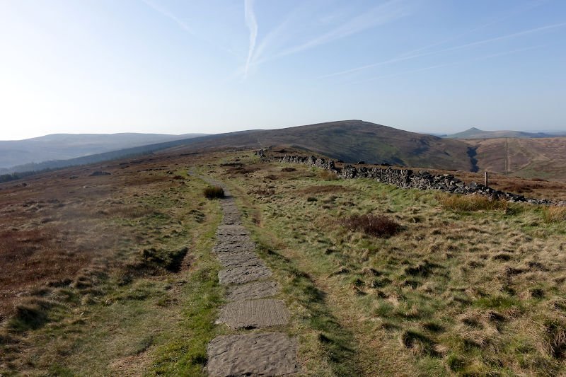
The entirety of the ridge path is clear and well-used, with a flagstone base making the going pretty easy.
Shining Tor
Save your sandwiches for the sublime sweeping vistas that spill out from the summit of Shining Tor (559m). Towering above the famous A537 Cat and Fiddle road, the exposed grassy moorland summit is marked by a trig pillar and crossed by a stone wall.
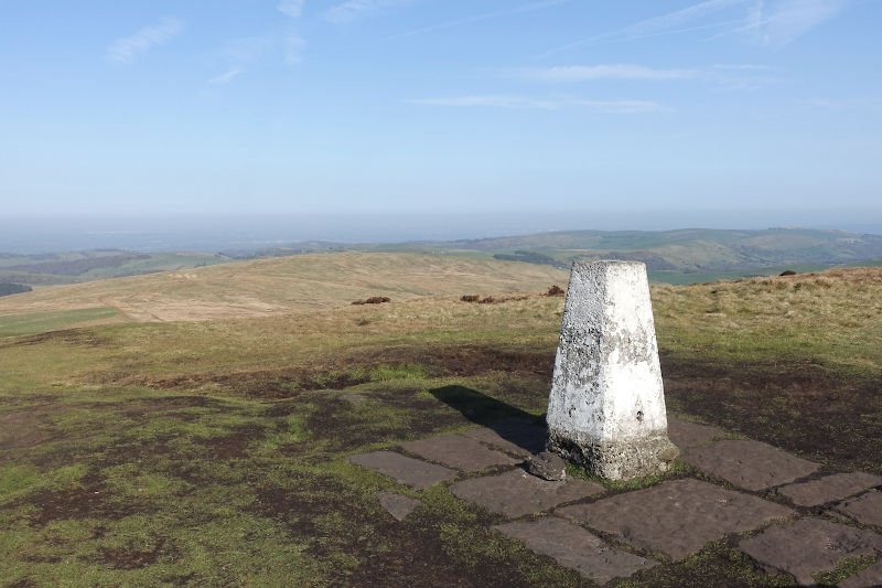
Make your way towards the craggy edge and on a clear day your reward is a slide show of distant landmarks, including Jodrell Bank, Manchester, Manchester Airport, the Cheshire plain and on a particularly clear day even Snowdonia!
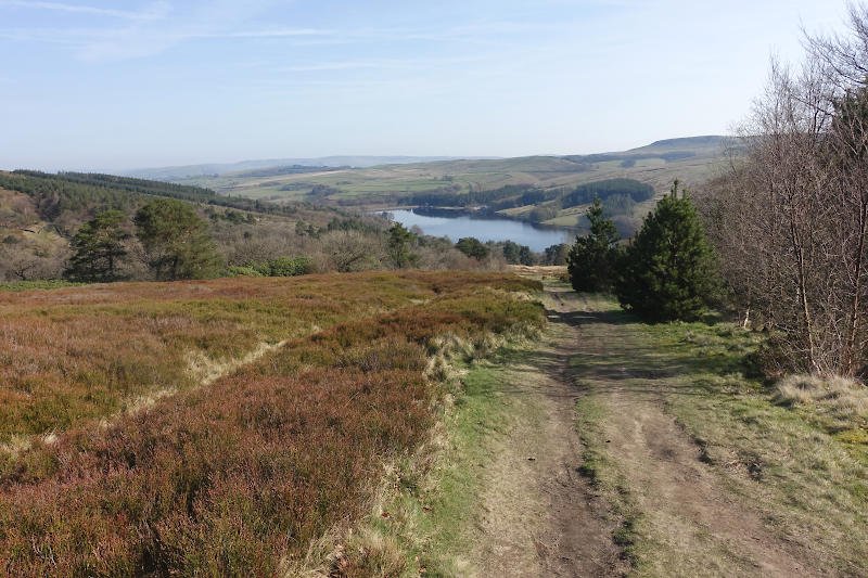
Errwood Reservoir
The descent back to Errwood Reservoir is a chance to stretch out the legs and enjoy the scenery as you drop back into the valley. By the time you reach the reservoir again, you’ll have clocked up a satisfying circular route with two Cheshire summits under your belt!
Hazards
- Boggy ground: possible after heavy rain, especially between Cats Tor and Shining Tor. Gore-Tex shoes = good life choices!
- Slippery flagstones: Great for erosion control, less great for staying upright if it rains.
- Shining Tor summit: the crag is exposed, be extra careful in high winds and poor visibility.
- Navigation: Paths are clear, but in poor visibility it’s easy to lose bearings on the ridge.
Remember – we cannot highlight all potential hazards when out in the great outdoors. Safety is ultimately down to you. Educate yourself in safety, weather reports, navigation and equipment specific to the activity you intend to undertake and conditions/terrain you may encounter! Check out adventuresmart.uk for general outdoor safety considerations – and activity specific guidance for hill walking, paddle boarding, mountain biking and open water swimming.